Simultaneous Localization and Mapping
134 papers with code • 0 benchmarks • 18 datasets
Simultaneous localization and mapping (SLAM) is the task of constructing or updating a map of an unknown environment while simultaneously keeping track of an agent's location within it.
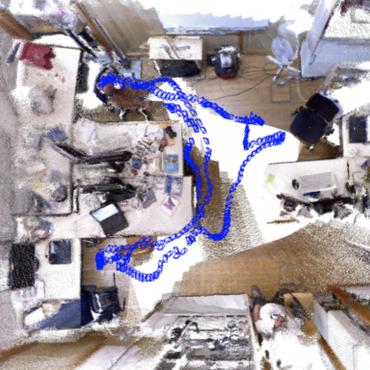
( Image credit: ORB-SLAM2 )
Benchmarks
These leaderboards are used to track progress in Simultaneous Localization and Mapping
Libraries
Use these libraries to find Simultaneous Localization and Mapping models and implementationsDatasets
 TUM RGB-D
 Virtual KITTI
 Virtual KITTI 2
 InteriorNet
 New College
 TUM monoVO
 S3E
S3E


Most implemented papers
PyRobot: An Open-source Robotics Framework for Research and Benchmarking
This paper introduces PyRobot, an open-source robotics framework for research and benchmarking.
A Fast and Robust Place Recognition Approach for Stereo Visual Odometry Using LiDAR Descriptors
Place recognition is a core component of Simultaneous Localization and Mapping (SLAM) algorithms.
Fast and Incremental Loop Closure Detection with Deep Features and Proximity Graphs
anshan-ar/fild
•
 •
•
In recent years, the robotics community has extensively examined methods concerning the place recognition task within the scope of simultaneous localization and mapping applications. This article proposes an appearance-based loop closure detection pipeline named ``FILD++" (Fast and Incremental Loop closure Detection). First, the system is fed by consecutive images and, via passing them twice through a single convolutional neural network, global and local deep features are extracted. Subsequently, a hierarchical navigable small-world graph incrementally constructs a visual database representing the robot's traversed path based on the computed global features. Finally, a query image, grabbed each time step, is set to retrieve similar locations on the traversed route. An image-to-image pairing follows, which exploits local features to evaluate the spatial information.
Robust Odometry and Mapping for Multi-LiDAR Systems with Online Extrinsic Calibration
This paper proposes a system to achieve robust and simultaneous extrinsic calibration, odometry, and mapping for multiple LiDARs.
Self-Supervised Learning of Lidar Segmentation for Autonomous Indoor Navigation
utiasasrl/crystal_ball_nav
•
 •
•
We provide insights into our network predictions and show that our approach can also improve the performances of common localization techniques.
CholecSeg8k: A Semantic Segmentation Dataset for Laparoscopic Cholecystectomy Based on Cholec80
Each of these images is annotated at pixel-level for thirteen classes, which are commonly founded in laparoscopic cholecystectomy surgery.
Unsupervised Scale-consistent Depth Learning from Video
We propose a monocular depth estimator SC-Depth, which requires only unlabelled videos for training and enables the scale-consistent prediction at inference time.
STUN: Self-Teaching Uncertainty Estimation for Place Recognition
ramdrop/stun
•
•
Then, supervised by the pretrained teacher net, a student net with an additional variance branch is trained to finetune the embedding priors and estimate the uncertainty sample by sample.
BoW3D: Bag of Words for Real-Time Loop Closing in 3D LiDAR SLAM
To address this limitation, we present a novel Bag of Words for real-time loop closing in 3D LiDAR SLAM, called BoW3D.
Point-SLAM: Dense Neural Point Cloud-based SLAM
eriksandstroem/point-slam
•
•
ICCV 2023
We propose a dense neural simultaneous localization and mapping (SLAM) approach for monocular RGBD input which anchors the features of a neural scene representation in a point cloud that is iteratively generated in an input-dependent data-driven manner.
