
BAAI-VANJEE Roadside Dataset: Towards the Connected Automated Vehicle Highway technologies in Challenging Environments of China
As the roadside perception plays an increasingly significant role in the Connected Automated Vehicle Highway(CAVH) technologies, there are immediate needs of challenging real-world roadside datasets for bench marking and training various computer vision tasks such as 2D/3D object detection and multi-sensor fusion. In this paper, we firstly introduce a challenging BAAI-VANJEE roadside dataset which consist of LiDAR data and RGB images collected by VANJEE smart base station placed on the roadside about 4.5m high. This dataset contains 2500 frames of LiDAR data, 5000 frames of RGB images, including 20% collected at the same time. It also contains 12 classes of objects, 74K 3D object annotations and 105K 2D object annotations. By providing a real complex urban intersections and highway scenes, we expect the BAAI-VANJEE roadside dataset will actively assist the academic and industrial circles to accelerate the innovation research and achievement transformation in the field of intelligent transportation in big data era.
PDF Abstract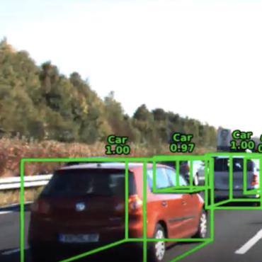


 BAAI-VANJEE
 ApolloScape
 A2D2
A2D2
 A*3D
A*3D
