Cloud Removal for Remote Sensing Imagery via Spatial Attention Generative Adversarial Network
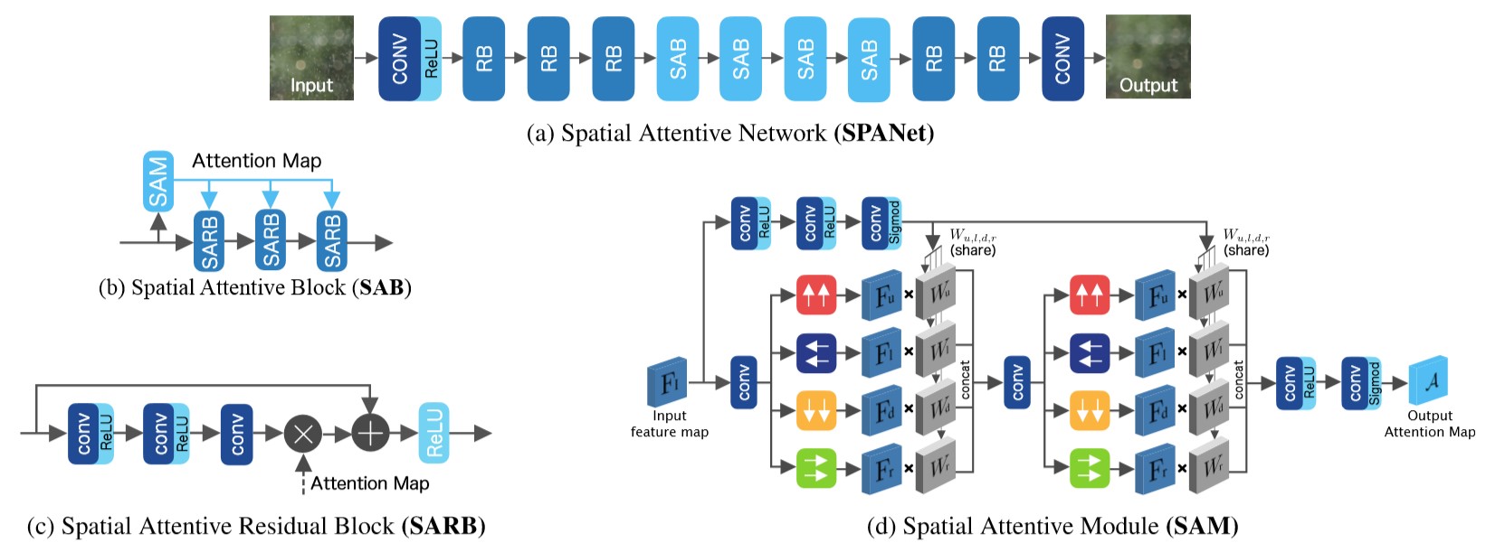
Optical remote sensing imagery has been widely used in many fields due to its high resolution and stable geometric properties. However, remote sensing imagery is inevitably affected by climate, especially clouds. Removing the cloud in the high-resolution remote sensing satellite image is an indispensable pre-processing step before analyzing it. For the sake of large-scale training data, neural networks have been successful in many image processing tasks, but the use of neural networks to remove cloud in remote sensing imagery is still relatively small. We adopt generative adversarial network to solve this task and introduce the spatial attention mechanism into the remote sensing imagery cloud removal task, proposes a model named spatial attention generative adversarial network (SpA GAN), which imitates the human visual mechanism, and recognizes and focuses the cloud area with local-to-global spatial attention, thereby enhancing the information recovery of these areas and generating cloudless images with better quality...
PDF Abstract


 SEN12MS-CR

